Warning: Undefined array key "file" in /mnt/web506/d2/98/570398998/htdocs/wordpress/wp-includes/media.php on line 1763 Warning: Undefined array key "file" in /mnt/web506/d2/98/570398998/htdocs/wordpress/wp-includes/media.php on line 1763 Warning: Undefined array key "file" in /mnt/web506/d2/98/570398998/htdocs/wordpress/wp-includes/media.php on line 1763 Warning: Undefined array key "file" in /mnt/web506/d2/98/570398998/htdocs/wordpress/wp-includes/media.php on line 1763

STRUCTURAL MONITORING & DIGITAL AS-BUILT

Capture structures precisely.

Monitor continuously.

From geodetic as-built surveys and laser scanning to high-precision GNSS monitoring and centralized analysis on navXBridge.

INTEGRATED APPROACH

Capture. Monitor. Understand.

Structural monitoring does not begin with the first sensor. A reliable as-built survey establishes the geometric baseline. Monitoring records change. Analysis makes it traceable and actionable.

01 · AS-BUILT

Capture the baseline precisely.

Geodetic as-built survey, laser scanning, control points, point clouds, sections and digital as-built models.

02 · MONITORING

Measure change
continuously.

High-precision GNSS sensors, IMU and additional project-specific measurement methods for permanent or periodic monitoring.

03 · DATA

Bring measurement data together centrally.

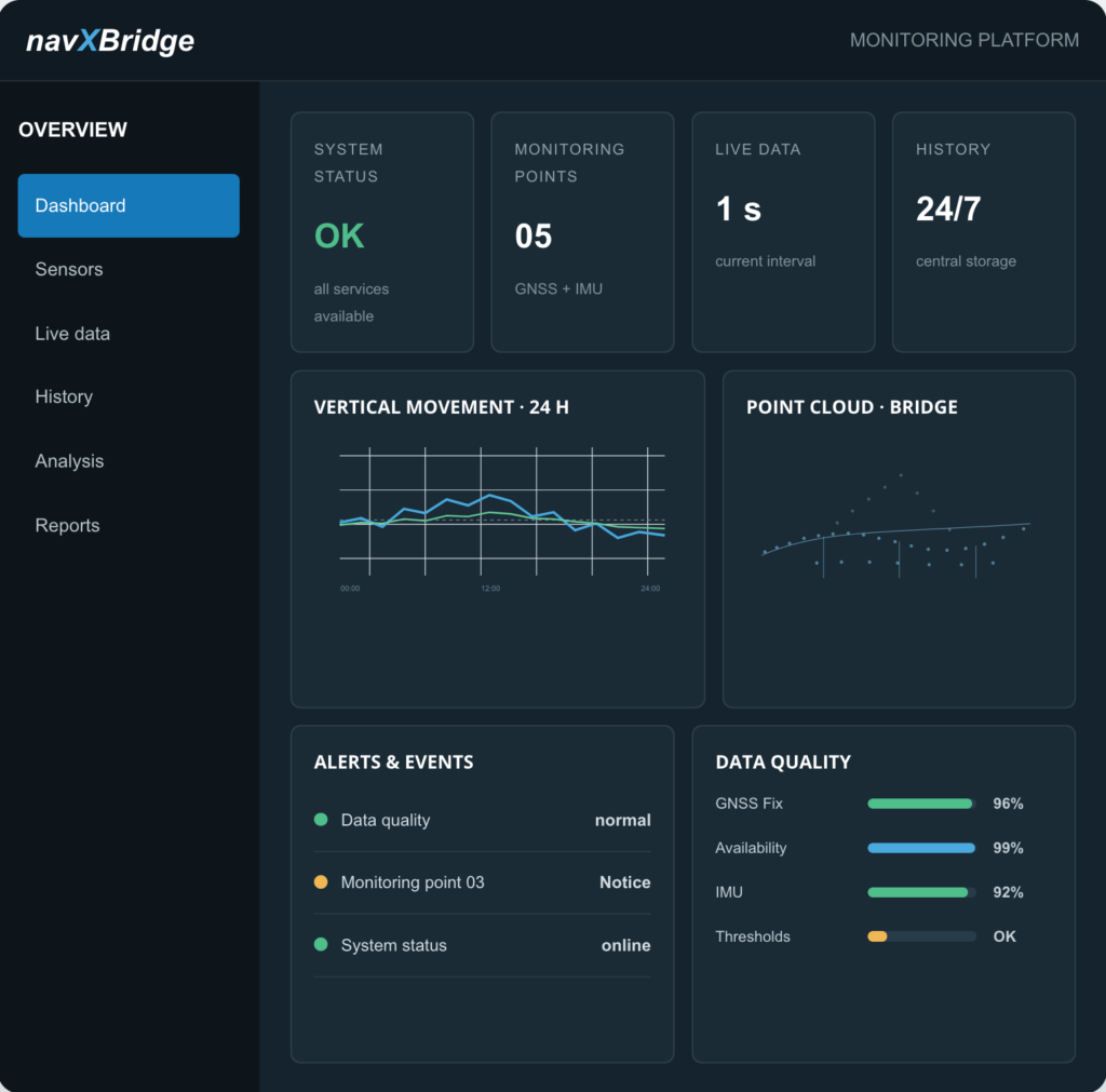
navXBridge combines sensor status, live and historical data, visualization, quality control, analysis, reports and project-specific alerting.

OUR SERVICES

From as-built survey to alert notification.

Services can be commissioned individually or combined into an integrated monitoring and documentation system.

GNSS structural
monitoring

Continuous or periodic high-precision 3D position measurement at defined monitoring points—including reference station, data quality and time series.

PERMANENT · PERIODIC · 3D

Geodetic as-built
survey

Establishment of measurement and control networks; capture of relevant geometry, elevations, axes, bearings, components and reference points.

GEOMETRY · ELEVATIONS · REFERENCES

Terrestrial laser
scanning

Area-based, non-contact capture of complex structural geometry with high point density and complete spatial documentation.

3D · AREA-BASED · HIGH POINT DENSITY

Point clouds
& 3D models

Registered and georeferenced point clouds, sections, views, as-built drawings and, if required, CAD/BIM-ready model bases.

POINT CLOUD · CAD · BIM

navXBridge data
platform

Central acquisition and structured storage of GNSS and sensor data with live view, history, system status and project-specific analysis.

LIVE · HISTORY · QUALITY

Analysis, reporting
& alerts

Trend and event analysis, threshold monitoring, regular reports, data export and defined notification channels.

TRENDS · THRESHOLDS · REPORTS

AS-BUILT SURVEY & LASER SCANNING

Capture precisely. Think digitally.

As-built documents are often incomplete, outdated or insufficiently accurate. Laser scanning and geodetic survey create a reliable geometric basis for planning, assessment, modification and later change analysis.

01 · CAPTURE

Measure on site

Geodetic survey, control points and area-based 3D laser scanning.

02 · POINT CLOUD

Register the data

Combine, georeference, clean and quality-assure the scans.

03 · MODEL

Model the as-built condition

Derive sections, views, 3D geometry and CAD/BIM-ready model bases.

04 · DELIVERABLES

Plan & document

As-built drawings, sections, models and verifiable documentation for further use.

MONITORING ARCHITECTURE

Sensors, data platform and analysis as one system.

The measurement concept is tailored to the structure, the engineering question, expected movement, measurement rate and required response time.

GNSS monitoring points

Reference station and monitored points

IMU & inclination

Acceleration and angular motion

Additional sensors

expandable by project

Dashboards

Live and long-term visualization

Reports & export

scheduled or event-based

Alerts

Thresholds and notifications

One platform for operation, analysis and traceable records.

Central data acquisition

Measurement data from different sources is captured in a structured way, time-ordered and stored by project.

Live & history

Current measurements and long-term time series can be viewed and compared together.

Data quality

Status, availability, fix quality and completeness are made visible as part of the measurement.

Analysis & export

Analyses, reports and project-specific exports support documentation and decision-making.

HOW WE WORK

Structured. Precise. Traceable.

01 –
Understand the task

Clarify the structure, engineering question, risks, movement magnitudes and required response time.

02 –
Capture the as-built condition

Document the reference system, as-built survey, laser scanning and initial condition.

03 –
Plan measurement concept

Define sensors, monitoring points, data paths, measurement rate, thresholds and analysis.

04 – 
Install & operate

Install sensors, connect navXBridge, verify data quality and support operation.

05 –
Analyze & report

Analyze, document and communicate trends, events and changes.

APPLICATIONS

For structures where change matters.

TRANSPORT INFRASTRUCTURE

Bridges

Long-term behavior, temperature response, traffic events, settlement and local deformation.

GNSS · IMU · Laser scanning

HYDRAULIC ENGINEERING

Dams & hydraulic structures

Deformation, inclination, settlement and long-term change of large structures.

Monitoring · Reference network · Reports

BUILDINGS

Buildings &
towers

Settlement, inclination, vibration and movement during operation, modification or special use.

As-built survey · Sensors

AS-BUILT

Modification & documentation

Complete geometric as-built basis for planning, verification, rehabilitation and documentation.

Point cloud · CAD · BIM